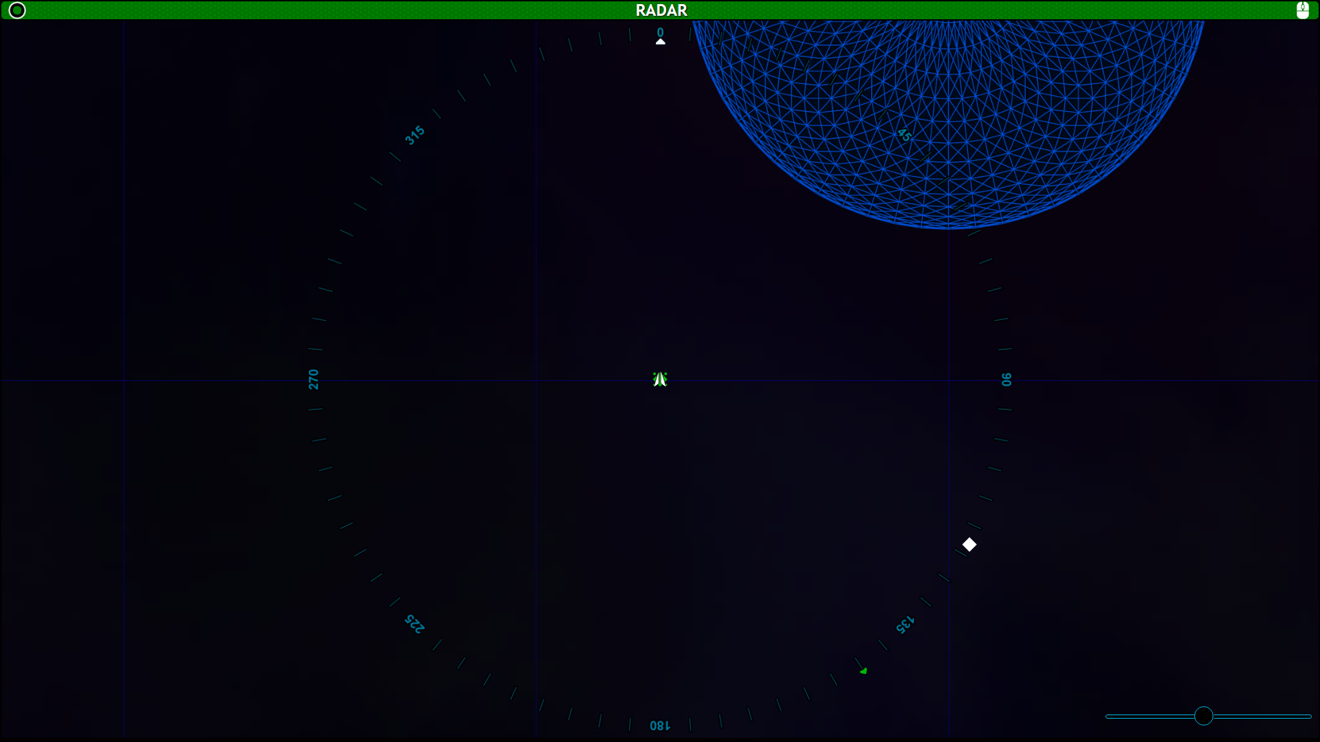
Radar or Local Map
The Radar, or Local Map, is the top down view of the 3 dimensional space around the Horizons. In the Flight, Tactical, and Science Consoles, the map area is clickable allowing you to select objects to target them and interact with them. Because this is a 2 dimensional rendering of a 3 dimensional space, sometimes there will be a stick or tail extending up or down from an object on the map, indicating that they are above or below the plane that the Horizons is occupying.
Features
LSG Toggle

In flight and Sciences, the Local Radar has the LSG toggle, allowing you to switch between the Local Radar, System Map, and Galaxy Stellar Navigation. Tactical does not have the LSG toggle, as they will only interact with the local environment.
Zoom Slider

The Radar and Local Maps have a slider in the bottom right, allowing you to zoom your view in or out to get more detail on objects around you, or a wider view of the local area.
Galactic Compass
There is a 360 degree compass on the Radar screens. This is a useful point of reference for the captain to give orders for a heading for flight, refer to a target for Tactical, or give and receive information from sciences. For example: in the Radar image above, the unknown contact is between the 115 degree and 120 degree hashes, the captain could ask sciences to “scan the unknown at 117 on the galactic compass,” or “Scan the unknown east-south-east of us.”
Station Specific features
Flight, Tactical, and Sciences have some features specific to their console with the radar screen. You can find more information about them on their specific pages.
Bridge Stations : Flight | Tactical | Operations (Comms) | Science | Engineering | Captain
Ancillary Stations/Displays : Center | Stellar Navigation | Stellar Body | Star System | Alert Status | Shield Status | Cargo Hold | Radar | IRIS
In Progress (Incomplete) Consoles/Displays : Crew Roster | Collision Alarm | Dashboard | Deck Status | Target | Scan | Vessel Status
Admin Consoles : Game Master | Mission Control | Mission Status | Designer
